Municipalities

Software for small and large municipalities with varying needs

All Sizes

We assemble our software modules to service both big and small municipalities.

A Multitude of Different Needs

We offer software that helps you navigate both times of crises and daily tasks based on your needs as simply and efficiently as possible. Our system is of the SaaS type, which means that we are responsible for the hosting and that you can choose the modules that make sense for you. We of course help you get started with both setup and implementation.

Insurance case management, administration and statistics for prevention

You can get help with asset and insurance management in relation to property damage and work injuries. For both central and decentralized reporting. Have the damages shown on a map to better prevent damage in the future.

Cross-functional crisis management

When a crisis strikes, it is important to be ready with the right tools. We offer simple crisis management that provides a comprehensive overview and can be used for major and minor incidents, with the possibility of relevant controls and checklists in relation to the individual incident. For reporting from the field with computer, smartphone or tablet - adapted to the individual device - with the possibility of intelligent two-way communication over several channels.

Integration with other Systems

We have a wide experience in integrating with other systems, so in connection with work injuries we have, for example, easy integration with the Danish governmental system EASY, and we can send both communication out and receive it in the system for external forms, such as emails and text messages.

SaaS: Software as a Service

By having a software subscription you aovid the hazzle of server and client administration. Often, as in our case, you access data and software via an internet browser, and you can choose the exact moduls that reflect your needs.

Crisis Management

Stay on top of things, follow up on developments, and communicate

MANAGEMENT DASHBOARD

Allows at the same time to monitor and work on multiple levels of information relating to a given situation.

  • Full overview of the event on one screen.
  • Multi-level dashboards possible on the same screen.
  • With the RMG C3 Management Dashboard, you get a greater overview of the events and thus help to ensure your operation.
  • Gives management the full overview so they have the right basis for decision-making.

MASS COMMUNICATION

Make quick contact at crisis situations or scheduled events.

Information - Alarm - Evacuation - Mobile employees.

  • Quickly connect when it matters most.
  • Solves the challenge of sending out many SMS or emails in these situations and the subsequent processing of the incoming replies.
  • Answers are handled intelligently so that further processing is made easy and manageable.
  • Decide for yourself how the communication should take place – one- or two-way communication – with or without response to the information sent.

We have over 20 local phone numbers registered around the world to ensure the reception and sending of answers when using telephony.

CONFERENCE CALL

Obtain a common basis for decisions by quickly gathering relevant people.

Status meeting - Crisis - Ad hoc management and board meeting - Project meeting - Information meeting.

  • Ideal system for crisis groups, management boards and boards where it is important that the responsible persons are informed and involved.
  • RMG C3 ensures contact by continuously ringing the people's phones until contact is made – no matter where in the world the persons are located.
  • The participants are guaranteed a rapid common understanding of the situation and thus a common basis for decision-making.
  • The automatic log records the meeting and all decisions made in connection for documentation purposes.

Insurance Claims and Violations‎

‎Reporting, administration, and prevention‎

INSURANCE

Quick, easy, and simple way to manage insurance claims and/or work injuries.

  • Simple and logical structure – and can be customized according to your wishes.
  • Role-controlled access and management of users at different levels – both internal and external.
  • You get an efficient case management process that, in an easy and manageable way, ensures you the different workflows and processes that you deem necessary.
  • Information should only be typed once on each case, handling can be done by different departments – with different needs for information and actions, in relation to the individual injury or incident.

VIOLATIONS

Allows for the detection of violations, acts of violence or internal incidents.

  • Recording of violence incidents in the school area.
  • Registration of violations in the care area.
  • Recording events in other internal areas where an overview is required.

InsuranceGIS

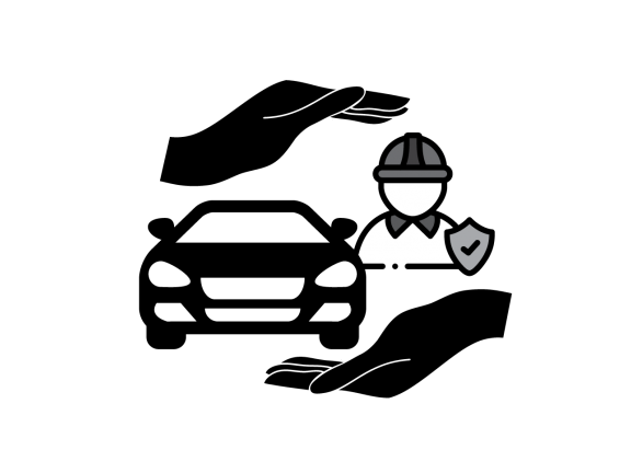
‎Measure your efforts and prevent incidents better with InsuranceGIS.‎

‎Identify vulnerable areas. Where is the most vandalism going on? Which locations are the most vehicle damage recorded? Where do the most costly injuries occur?‎

‎On the dynamic map, you can see the location of schools, nursing homes, emergency services, etc.m., contact information and action plans for the different locations. As well as location of TV monitoring and other installations.‎

‎The insurance claims are reported in RMG C3. With the addition of InsuranceGIS, you get a geographical overview of the locations that take up the most space in the damage picture, and thus the central management gets the optimal decision-making basis for where it is most important to take action.‎

‎With the map view module, you can select data layers on and off, so that e.g. vandalism can be separated from car damage, and you can click directly on to the individual notification or the associated contact information, action plans, etc.m. Alarm and security patrols can view drawings, necessary contact information, etc., which will make their efforts more effective.‎

‎With the geographical overview, property damage, locations, and additional information are collected on the same map. This gives you a sound basis for decision-making for future preventive efforts, such as setting up cameras and alarms, further SSP cooperation, patrolling, and other actions.‎